WATER ACTION IN KARST REGION AND RESULTING LANDFORMS – ADVANCED PHYSICAL GEOGRAPHY
What is the Karst?
Karst is the term derived from Yugoslavia which refers to the features formed in the limestone region. This come from limestone plateau area in Yugoslavia, where a number of landforms have developed due to carbonation and solution effects.
BASIC TERMINOLOGIES RELATED TO KARST
i. Karst regions: Are the areas where rock predominate is limestone. Example; Tanga, Madagascar, Zanzibar, etc.
ii. Karst sceneries: Are the physical features which formed in karst regions due to influence of carbonation and solution processes. It is called karst landscape.
iii. Karst processes: Are the weathering processes responsible for the formation of karst sceneries in the karst region. These processes include carbonation and solution.
HOW KARST REGION ARE FORMED
The Karst region are formed like as follow;
If the area dominated by Calcareous rocks, these rocks composed by calcium carbonate example limestone rocks (composed by calcium carbonate (CaCO3) ) and Dolomite rock composed by calcium magnesium carbonate (CaMg(CO3)2) ). These rocks dissolved when contact with rain water with carbon dioxide i.e weak carbonic acid. Therefore, they converted from calcium carbonate to calcium bicarbonate which is weak and so soluble, hence carried away by ground water as solution. This process is known as carbonation or solution.
The reaction formula;
CaCo3 + H2O + CO2 Ca(HCO3)2.
(calcium carbonate) (water) (carbondioxide) (calcium bicarbonate)
CaMg(CO3)2 + 2H2O + 2CO2 Ca(HCO3)2 + Mg(HCO3)2
(Dolomite)(water) (carbondioxide) (calcium bicarbonate) (magnesium bicarbonate)
CONDITIONS/FACTORS FOR THE FORMATION OF KARST SCENERIES
i. Should be presence of calcareous rocks for carbonation and solution to take place.
ii. The rocks should be well jointed and fractured to make them permeable. This enables water to pass through downward.
iii. There should be presence of moderate to abundant rainfall (should be presence of wet climate) i.e equatorial to temperate. This accelerates carbonation and solution processes.
iv. The water table should be available very deep below the surface, so that water is able to move further down through the rocks.
CHARACTERISTICS OF KARST REGION
i. Intermittent Surface drainage. Generally, the stream cannot flow for long distance as they disappear underground through the swallow holes. Eg. Malampaka map sheet.
ii. Bare rocks and valley. There are outcrops of bare, rugged rock, and steep sided dry valley.
iii. Depressions. There are several holes of different sizes on the surface.
iv. Residual hills of various sizes and shapes on the surface.
v. Subterranean network of caverns with stalactite and stalagmites.
FEATURES / LANDFORMS / SCENERIES OF KARST REGION
The karst features can be categorised into two (2) groups. These are;
- Surface karst features (terranean features/landforms)
- Sub-surface karst features (sub-terranean features/underground features).
A: SURFACE KARST FEATURES
These are features which formed on the surface of a karst region. These are;
Swallow holes (Sink holes or ponor):
Are vertical holes like landform formed as a result of enlargement of the rock crakes caused by the accumulation of water on the surface of limestone region.
Doline:
Is a large depression formed by enlargement or join together the swallow holes. The diameter of doline range from a few meters to 100m while the depth varies from a few meters to 300m.
Uvala:
This is the large steep holes formed when dolines coalesce (join together). Uvala can be a diameter about one kilometer.
Polje:
Is a large depression, which is formed when several Uvala collapse. It often has a flat floor, steep sided walls, interdependent surface drainage system on their floor, irregular borders, central lake and red clay soil called Terra rosa soil.

Limestone pavement:
This is a bare rock surface characterized by numerous grooves (grikes) and ridges (clinks).
Grikes (Grykes)
These are the deep irregular grooves (gullies).
Clints
These are the ridges or blocks or limestone rock separating the grikes in the Karst region.
Karren
Small hollow that forms on the surface of a limestone clint


Residual mountains, hills and scarp:
These are formed where there are hard rocks, which have not been eroded and hence remain standing above the surface as residual features.
Dry valley;
Is is a small valley without a permanent stream on the surface. It is formed the surface river disappear by sink down the ground through swallow holes.

Limestone gorge:
it is a deep steep sided valley on a limestone landscape. It is formed by large river passing through the limestone area. This river erode vertically to deepen bed. Example; Manambolo river central Madagascar.
Resurgence springs / river:
It is a stream which reappears on the surface that had previously vanished underground.
B: SUBSURFACE KARST FEATURES
These are physical features which form below the surface in a karst region. These are;
i. Caves and caverns:
Caves are the underground chambers in the karst region formed due to solution of calcareous rock underground. When a caves becomes extremely big it is called caverns. Example; Mangapwani caves in Zanzibar, Amboni cave in Tanga, etc.

ii. Stalactite:
Are finger like masses of calcite hanging vertically from the roof of the cavern or cave.
iii. Stalagmite:
Are stumpy rock mass, which grow from the floor of cavern or cave upward.
iv. Natural pillar:
Is the natural column or pillar formed either when the stalactite and stalagmite join together or when the stalagmite grows to the point of reaching the roof.

v. Underground river:
Is the river stream formed when water sinks underground through the sinkholes and joints. The underground river can reappear on the surface as a spring or as a river. Such river which appears on the surface is called Resurgent river.

vi. Anthodites:
These are delicate flower like structure, which is formed when calcite is deposited on the roof of the cavern.
vii. Helictites:
These are the crystalline formation of very varied shapes. They may be as thin as threads, arranged in spirals or loops and can rejoin the ceiling of the cave.
viii. Limestone pool:
These are small depressions filled with water along a floor of a limestone cave
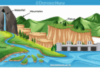
THE VALUE OF UNDERGROUND WATER
i. Springs provide site for settlement in many regions in the world. Example in U.K, etc.
ii. Water from wells are used for irrigation in the dry areas eg. in desert land, etc.
iii. Springs form source of water for both domestic and industrial areas.
iv. The hot spring contain medicinal water
v. Underground steams are used for generation of geothermal energy. vi. Springs are used as tourist attraction especially the hot springs and geyser example in the Yellow stone national park in U.S.A.
POLLUTION OF UNDERGROUND WATER
What is the water pollution?
Water pollution is addition or introduction of unwanted substances in the water which are harmful to animals, human being and plants.
What is the underground water pollution?
Is the introduction or addition of any harmful substances which pollute or destroy the quality of underground water
CAUSES OF UNDERGROUND WATER POLLUTION
There are many causes of pollution of underground water. These are;
i. The run off containing wastes can percolate down through the swallow holes.
ii. When the water table is too close to the ground surface pollute underground water because pollution from surface runoff never get filtered and thus lead to pollute underground water.
iii. Septic tank can also pollute the underground water when they are improperly located or when they break, thus causing the leakage of sewage diffusion to the wells.
iv. City sewage disposal of untreated (wastes) water can lead to the contamination of underground water when pollutants reach the well.
v. Application of pesticides and fertilizers; this is because some chemical materials within fertilizers does not decompose completely in the soil; hence, they freely move with water into the ground hence become a source of pollutants.
vi. De-icing process on the roads where by washing chemical can go underground and thus pollute the underground water. Since they accompanied by chemicals such as sodium chloride, potassium, calcium chloride as well as alcohol and glycols.
vii. Acidic rains when falling on the surface may soak into the ground water leaching changing of water pH.
viii. Oil leaking from the containers or disposal of used oil can lead to the pollute underground water.
ix. Mining activities; example chemicals such as cyanide or sulphuric acid used to separate the mineral substance from ores when mixed to surface water can sink down hence pollution of ground water.
REVISION QUESTIONS
Describe features found in karst regions.
Discuss the development of surface and subsurface features in Karst region (NECTA 1976) 3. What is karst scenery? Discuss the origin and nature of karst landscape (NECTA 1992)
READ FULL NOTES PDF
CLICK HERE TO GET FULL NOTES