WAVE / MARINE ACTION AND RESULTING LANDFORMS – ADVANCED PHYSICAL GEOGRAPHY
WAVE / MARINE
What is wave?
Wave is up and down movement of surface sea or ocean or lake.
SOME OF CONCEPTS RELATED TO SEA WAVES
Crest: Is the upper part of waves.
Trough: Is the lower (down) part of waves.
Wave length: Is the horizontal distance between a crest and crest or between trough and trough.
Wave amplitude: Is the difference in height between crest and trough.
Wave height: Is the vertical distance from crest to trough.
Wave speed: Is the measurement on how velocity of the waves related to distance in km per hour.
Swash: Is the sea water thrown by the waves on the shore when the waves entering the coast.
Back washes: Is the water returning the sea ward (backshore) during the sea waves repeat or after swash.
CAUSES OF WAVES (SEA WAVES)
i. Winds:
When the winds blow on the water surface cause friction drag as air trumble forward and finally develops circular motion that called waves. The powerfully waves associated with strong winds like hurricane known as storm surges. ii. Tectonic activities:
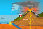
The tectonic movement associated with earth quakes and vulcanism near the coast or in the floor of sea can trigger to the formation of powerfully waves called Tsunami.
TYPES OF SEA WAVES
There are two (2) types of sea waves that responsible to erosion and deposition, and depend on the length of swash and backwashes. These are: –
1. Destructive waves:
These are waves whose back washes are stronger and more powerfully than the swashes. Therefore, the swashes are shorter and less powerfully. These waves are responsible to erosional process.

2. Constructive waves:
These are waves whose swashes are stronger and more powerfully than the backwashes. They are responsible to deposition process.

BASIC FUNCTION OF SEA WAVES
There are three basic function of waves. These are: –
i. Wave (marine) erosion
ii. Wave (marine) transportation
iii. Wave (marine deposition
WAVE (MARINE) EROSION
What is wave erosion?
Wave or marine erosion is the wearing away of the coastal rocks by action of waves. OR Wave erosion is the process where by waves attack the coastal rocks and carry the materials elsewhere for deposition.
The waves erosion almost occurs along the cost of sea or ocean or coast of lake.
PROCESSES OF WAVE EROSION
There are four (4) processes of waves erosion. These are: –
i. Hydraulic action:
Is the wearing away of coastal rocks by force of marine water thrown against the cliff face they will compress and increase pressure of the air in the cracks or joints.
The air will expand to weaken and break off pieces of rocks at foot of cliff face.
ii. Abrasion (corrasion):
Is the wearing away of coastal rocks by gridding action as a result of waves carrying abrasion tools like sands, pebbles and boulders against the cliff. The friction between the materials and cliff will result into wearing down of the cliff gradually.
iii. Solution (corrosion):
Is the dissolving action of soluble coastal rocks by waves. Where by, the marine water when come to contact with soft rock such as limestone rocks, chalk, etc that easily to dissolve wearing down as solution.
iv. Attrition:
Is the wearing down of the load as a result of collision (knocked) against one to another.
The broken material becomes smaller to be used as abrasion tools.
FACTORS AFFECTING THE RATE OF WAVE EROSION
The extent to which wave action shapes or modifies the coasts depends on the following factors:
Strength of the wind that blows over the sea
The stronger the wind the greater the effect. Usually, strong winds generate stronger waves which lead to more destruction or construction.
Depth of the sea water along the coast
Strong or weak wave formation depends on the depth of the sea. Normally, shallow water impedes waves forward movement, while deeper water encourages powerful strong waves to reach the shores. Strong waves have greater effect than weak waves.
Nature of the rocks on the coast
Weaker rocks are eroded easily than stronger ones. The chemical composition of the rocks also determines the rate of erosion in the coast.
Alignment of the coast
Waves reaching an indented coastline wear back the outstanding headlands which are suitable for the development of natural harbours while waves reaching a straight coast will be refracted.
Human activities
Such as building on cliff tops and removal of the beach materials contribute to more rapid coastal erosion. Human being can reduce the rate of erosion by constructing walls (groynes) and planting trees.
FEATURES (LANDFORMS) OF WAVES EROSION
The following are the erosional features by the waves. These are: –
Cliff:
It is a wall like steep slope facing the sea or ocean or lake made up of rocks. It is formed as a result of wave erosion along the headland or faulting process undercuts the shore to form a steep slope towards the sea or ocean. Some of cliff made by manmade. When waves break against the rock face, they cut a notch at the position where they break at high tide

Wave cut platform:
A wave cut platform is a wide and fairly flat part of the shore that develops when a cliff is pushed back (retreat land ward) by waves, whereby the rock wastes form a terrace. This terrace becomes widened to form a wave-cut platform.

Notch:
Is a small hole or line of weakness at the cliff base. It is well developed on the limestone rocks where corrosion remove loose materials and cause formation of small holes at the cliff floor.

Caves and ledges:
It is large hole that extends into a cliff face. When a cliff consists of layers of different rocks, or rocks with joints or faults, the less resistant rocks are eroded more rapidly. Through abrasion and hydraulic action, they are turned into hollows which later become caves at sea level while the most resistant rocks project seawater known as ledges.

Blow holes (glop):
It is an opening turned from a cave at the cliff to the upper part of land surface into the top of the cliff. It is formed due to vertical within a cave which enlarge and finally piece a hole at the roof of cave formed called blow hole.

Geo:
It is narrow steep sided inlet along the coast. It is formed when wave erosion enlarges a fault or opening (collapse) the roof between cave and blow hole as a result of narrow inlet called geo.

Bay / Gulf / Bight:
Is a wide inlet into the land by the sea or lake. It is formed when waves attack the coast made by alternate soft and hard rocks layer. The waves eroded soft rocks quickly and cause formation of wide inlet called bay or gulf or bight depending on their size.
Headland / Ras / Promontory:
Is a rock projection into the sea. It is formed when wave attack the coast made by both soft and hard rock, as a result of eroded soft rock easily and left hard rock that projecting to the sea called head land or Ras.

Arch:
Is a opening through two caves at headland. It is formed when caves develop on either sides of a headland and gradually join together.
Stack:
It is an isolated pillar at front of cliff line. It is formed when the roof of arch collapse and cause formation of isolated piece of land that called stack.
Stump:
It is an isolated rock below the water level that fronts a headland or a cliff line. It is formed by prolonged erosion when wave attack the stack and cause formation of very small isolated piece of land that called stump.


WAVE TRANSPORTATION
Wave transportation is the movement of eroded materials along the coast by waves.
WAYS OF WAVE TRANSPORTATION
Along the cast, waves transport their loads or materials through the following ways. These are:
Longshore drifting (littoral):
In this way, the materials moved by the long shore drift flow a zigzag movement along the shore. The swash flows to the beach at a oblique angle while the back washes return to the sea or lake along a straight line. This repeated back and forth movement of materials along the beach is called longshore drifting.

Under tow current:
Are the weak current of water flowing back into the sea flow under neath. Back washes flow back into the sea, some of it penetrate beneath the sea surface when it drags materials at the sea bottom to the sea ward. It is cause formation of sand bars.

Wind:
The wind may cause the thinning the by removing materials or thickening the beaches by bring (accumulation) materials. For instance; onshore wind and offshore wind transport large supply of sand materials along the coast. The offshore wind also generates undertow currents which carry materials from beach to seaward.

WAVE DEPOSITION
What is wave deposition?
Wave deposition is the wearing down of materials which was being transported by waves. OR Wave deposition is the accumulation of materials that eroded and transported by waves.
WAVES DEPOSITIONAL FEATURES
The following are the waves depositional features. These are: –
i. Beach:
A beach is an accumulation of sand and single between high and low tide level where the sea water is shallow. It is formed when constructive waves carry materials towards the shore. The swash deposits the load on the shore because the backwash is weaker than the swash as a result of sands and shingles accumulate on the shore and forming beach.
There are two types of beaches i.e normal beach and storm beach. Example of beaches like Coco and Kawe beaches in Dar es Salaam, Tunza beach in Mwanza (L. Victoria), Kiwengwa and Mangapwani beaches in Zanzibar, etc.

2. Off shore bar / Sand bar / Barrier beach:
Is an embarkment of sand built offshore which lies parallel to the coast. It is formed when the undertow currents accumulate the sands seaward and forming a ridge of sand parallel to the coast that separated to the coast by lagoon. Most of sand bar are temporary and they get submerged by waves.

3. Spit:
Is an embarkment of sand and pebbles with either or both attacked to the mainland and other end terminating to the sea. It is formed when larger sized shingle is deposited before finer sands. The finer sand will be carried towards the end of the spit leading to the extension.

Types of spit:
There are two (2) types of spit. These are;
a) Hocked spit:
Is the embarkment of sand and shingle attached to the mainland on its side but one side terminating in the sea being curved towards the mainland.

b) Cuspate spit:
Is the triangular shaped spit formed when the longshore drift from two opposite direction form spit which meet at right angle in the sea enclosing a lagoon.

c) Tombolo:
Is an embarkment of sands and shingles which links the mainland with an Island. It is formed when deposits of sands and shingles connects the Island with the mainland. Sometime two tombolo connect Island called double tombolo, or one tombolo connect Island called single tombolo. Example; Near Bukakata on the shore of Lake Victoria in Uganda, Ntainkalu tombolo on Lake Victoria at Iganga, Ras Hafun in Somalia, etc.

d) Mud flat and Salt marshes:
Mud flat refers to the platform of mud formed due to the deposition of salt together with river alluvium. If area of mudflat colonized by salt tolerant plants a marshland or swamp is formed called salt marshes. Example; Lamu mudflat at the East Africa coast, at the mouth of River Rufiji, etc.

e) Berms:
Are ridges like features, formed by the accumulation of the materials beyond the shore towards the land. Berms develop well on a shore where constructive waves are dominant and where swashes are stronger than the backwashes enough to deposits large materials at the farthest limit of swash action.

f) Dune belts:
Are the extensive sized mounds of loose sands grains along the coast deposited by wind. Dune belts like a parabolic dune shape, it is developed on the coast where winds are predominant on shore and are sufficiently strong enough to move a large supply of sands on land from a wide beach area. Example; Coast of Holland, etc.

viii. Lagoon:
Is a body of calm water which is separated from the sea by sandbank like sand bar or spit and enclosed them. Example; Nabugabo lagoon in the Lake Victoria near Masaka in Uganda, etc.
ix. Bay-bar (Baymouth barrier):
Is a type of spit that grows across the mouth of a bay to link the two headlands which is enclosed a bay. It is formed by similar process of spit formation, however the baybar continues projection of the spit parallel to the coastline with end up touching the other headland as a baybar. It enclosed a body of calm water called lagoon. Example; Nehrungen on the Baltic coast.

REVISION QUESTIONS
1. What the functions/actions performed by waves along the coast.
2. Describe features produced by wave erosion.
3. Examine the factors that influence the effectiveness of wave erosion.
4. Examine the factors that influence wave deposition.
5. Describe features produced by wave deposition
6. Destructive and Constructive waves are the determinants of landforms in the ocean. Justify this statement using four points in each case.
7. To what extent does a constructive waves explains geographical features in the marine water? Give six features to validate your response.
8. Evaluate the roles of Destructive waves on reshaping the marine basin. (six points)
9. With eight points, explain the role of backwash and swash waves in the oceans.
10. Describe six factors determine the destructives of waves along coastlines.
READ FULL NOTES PDF
CLICK HERE TO GET FULL NOTES