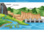
FLUVIAL / WATER ACTION IN THE DESERTS AND RESULTING LANDFORMS – ADVANCED PHYSICAL GEOGRAPHY
In general, rainfall is seldom in the deserts, but if it occurs it is the form of terrestrial rain occur as flash floods. Therefore, there are different features that occur due to fluvial erosion and deposition. These are;
I: FLUVIAL EROSIONAL FEATURES IN THE DESERTS
The following are desert landforms associated by fluvial action;
Rills:
These are the small and shallow grooves formed due to rill erosion associated by surface runoff.

Gully:
These are the deep, steep sided troughs produced when erosion enlarge the rills. The gulls are large and deep than the rills.

Wadis / Arroyo / Ravine / Chebka:
These are the steep sided, deep and often flat floored valley formed due to severe erosion by water in the desert. In Algeria called Chebka.

Dry river valley:
These are the river valley which remain dry after the streams of water dry during the dry season.
Example; Northern part of Kenya, also called Laghs or Lags.
Pediment:
Is the gently sloping platform formed when the edges of the desert or semi-desert mountain retreated by erosion of surface run off.
Pedi plains / Pedi planes:
These are the mult-concave features which result from the coalesce (combine) of several adjacent large-scale pediments. It is formed by wide spread surface water erosion on the surface desert.
Inselbergs:
These are the residual hills or rock masses formed by water erosion in the desert. They are smooth and rounded on top. They appear as isolated steep sided hills.Mesas and Buttes:
- Mesas: Are the extensive flat-topped residual table lands which are generally capped with resistant rock stratum.
- Buttes: Are smooth but prominent residual flat-topped hills usually capped with resistant rock stratum, which remain after denudation of a plateau in arid areas.

Gorge / Canyon:
Are steep sided, deeper versions of wadis. They are created by the incision (vertical/down ward erosion) by the action of flowing water in deserts.

Badland Topography:
Intricately rilled and barren terrain in arid regions. It is ommon in areas underlain by horizontal strata of shale and clay formations that are poorly consolidated and subject to rilling and gullying. It is an extensive network of convoluted rills and gullies forming a “badland” topography.

II: FLUVIAL DEPOSITIONAL FEATURES IN THE DESERTS
The following are the depositional features in the desert formed by fluvial action;
i. Alluvial fan and Alluvial cone:
- Alluvial fans: These are the fan shaped formed when large quantities of sediments are deposited at the foot of steep slopes.
- Alluvial cones: these are features which look like alluvial fans in shape but are consisted of coarser material. Hence, they are formed in the same way to alluvial fans.

ii. Bajada / Bahada:
These are the continuous, gently sloping features with undulating surface formed when either alluvial fans or cones coalesce (combine) during deposition of more sediment at the foot of a steep slope.
iii. Peri pediment:
Is is a feature with a gentle slope, formed when the alluvial deposits overlie the edge of the pediment surrounding the sebkha.

iv. Playa / Salina and Playa lake (Salina lake):
Playa lake are the temporary lake, there is shallow and steep sided at the central part of the wadi in the desert region. In Sahara, they are called Playa or Salina or salars, and produce salt bed.
Example; Sierra Nevada and Arizona in USA.

REVISIONS QUESTIOS
1. Wind action in desert
2. What the functions/actions performed by wind in the deserts
3. Explain the processes involved in wind erosion and features produced by wind erosion in deserts.
4. Examine the factors that influence wind deposition then show features produced by wind deposition in deserts.
GLACIATION/ACTION OF ICE
What is the glacier?
Glacier is a thick of ice and originated on land from the compaction and recrystallization of snow.
What is the glaciation?
Glaciation is the sculpturing of the landscape by moving ice.
The glacier is common in mountain areas and cold climatic regions eg. polar climate.
TERMINOLOGY USED IN GLACIATION
The following are some terminology related to glaciation. These are;
i. Pleistocene period:
Is the period of glacier formation. This consisted of an alternate of glacial (time of ice accumulation) and interglacial (time of ice retreat).
ii. Snow:
Is the ice crystals that falls on the earth’s surface.
iii. Snow field:
Is the area where by snow persists throughout the year. Example Greenland, Antarctica
iv. Snow line:
Is the outer limit of the permanent snow.
v. Ice / nerve / firm: Is the compact of ice mass formed when snow accumulate in a region.
vi. Ice sheet:
Is a continuous mass of ice covering a large area of the ground surface. It cover extensive flat surface. The peak of very high mountain may project above the ice sheets known as Nunatak.
vii. Ice berg:
Is a large mass of ice block floating on the sea and ocean. Sometime cause accident like Titanic accident in 1912 at the Atlantic Ocean. viii. Ice cap:
Is a mass of ice covering a highland or plateau and spread out radially. Its cover mountain top.
ix. Ablation:
Is a technical term in glaciation describing the condition in which the glacier is lost either by melting or by evaporation.
x. Piedmont glacier:
Is the valley glacier which located at the foot, or base of mountains. In general it is found in lowland.
xi. Alpine glacier:
It is also called mountain glacier. This glacier found in high up on the mountain surrounding by mountain terrain.
xii. Valley glacier:
It is a long, narrow feature resembling a river of ice which spills out of its originating basin and flows down valley.
TYPES OF GLACIERS
There are five (5) major types of glaciers. These are: –
Niche glacier:
Are the small glacier which occupy small hollows and valley on glaciated mountains.
Cirque glacier:
Are the glacier which occupy armchair shaped depressions which a steep back wall.
These are larger than niche glacier.
Valley glacier:
These are glacier which cover a valley on glaciated mountain. They usually follow former river courses and are bounded by steep sides.
Piedmont glacier:
These are valley glaciers which extent onto lowland.
Continental glacier:
These are valley glaciers which occupy an extensive land surface. This can either be ice sheets or ice caps. It is formed in non-mountainous areas.
GLACIAL PROCESS / FUNCTIONS
There are three (3) basic process of glacier. These are: –
- Glacier erosion.
- Glacier transportation.
- Glacier deposition.
GLACIER EROSION
Is the wearing a way of landscape by moving ice or glaciers. As glacier advance, they wear away the valley sides and bedrocks.
PROCESSES OF GLACIER EROSION
There are three (3) basic processes of glacier erosion. These are;
i. Plucking / Exaration:
Is the wearing away of the bottom of blocks of rocks due to frozen into the sides or bottom of a glacier.it is occur due to melt water penetrates the cracks and joints along the rock floor of the glacier and refreezes.
ii. Abrasion / rasping / corrasion
Is the process which involves the scratching, or scraping, or scouring, or smoothing, or polishing of landscape by glacier. In this case, the rocks frozen at the base of the glacier used as abrasion tools for smoothen and polish the bed rocks.
iii. Sapping / quarrying / gouging / nivation:
Is the break up of rock by alternate freezing and thawing of water at the bottom of the glacier which is contact with valley floor. Its caused by alternate freeze and thaw action.
It occur on the valley sides and cause formation of deep hollow like cirques.
FACTORS INFLUENCING GLACIAL EROSION
The rate of glacier erosion influencing by the following factors. these are;
i. Nature of underlying rock. The erosion is more on soft and well jointed rocks.
ii. The speed of the glacier. The higher speed the greater erosion.
iii. The weight and thickness of the ice. The thicker and heavier the mass of ice the faster the rate of erosion.
iv. Availability of rocks debris. The rocks debris act as abrasion tools. The larger the amount of debris, the more the erosion.
GLACIER EROSIONAL FEATURES (LANDFORMS)
There are two (2) of glacier erosional features. These are: –
a) High land / Up land / Alpine glacier erosional features.
The upland or alpine glacial erosional features (landforms) are like as follow;
i. Cirque / Corrie / cwm:
It is arm chair shaped depression with a steep back wall and a rocky basin. It is formed by both sapping, abrasion and plucking. Where the back wall formed due to plucking, while the hollow formed due to abrasion and deepened by sapping process. During summer the glacier melt and cause to form lake called Cirque lake or Tarn lake. Cirque also known Corrie in Scotland, and Cwm in Wales. Other names are Coire, Combe, and Kar. Example of Cirque lake is lake Telekton on Mt. Kenya.
ii. Arete:
Is a narrow, steep sided, knife edge ridge separating two Cirques radiating from the top of pyramidal peak. It is formed by cutting back of the back wall of cirque by plucking process.
iii. Pyramidal peak / horn:
Is a pointed (jugged) peak with radiating aretes. It is formed when three or more cirques develop along the mountain sides and gradually produce jugged and sharp sided peak resembles a pyramid. Example; Mother horn in Swiss Alps.

iv. Col:
A narrow notch on an aretes between opposite cirques. It is formed by the process called head wall recession due to plucking process. The two cirques meet and create a notch or gap on the aretes.
v. Hanging valley / tributary valley:
Is the tributary valley of the U-shaped valley, left (hanging) above the floor of Ushaped (main) valley. It is formed when a tributary glacier has eroded at a slower rate than a main glacier, so that when glacier melt it is left hanging high above the main valley. It is characterised by water falls.
vi. Truncated spurs:
This is an angular ridge separated from one to another by hanging valley. It is formed when the glacier on tributary valley widens its valley sides leaving behind the narrow ridge upstanding between them. Example; Mt. Ruwenzori at Mobuku valley.
vii. Fiord / Fjoid / Glacier trough / U-shaped valley / Main valley:
It is steep sided, flat bottomed, wide valley, which contains features produced by by both erosion and deposition features aby glacier. It is formed when the main glaciated V-shaped valley deepens and widens up by the glacier along the coast. The main Ushaped valley eventually drowned by the sea forming submerged highland coast. Sometime the glacier trough occupied by water during summer to create lake called ribbon lake or trough lake or figure lake. Example; Switzerland in Alps Mt.

viii. Ribbon lake / Finger lake / Trough lake: A lake that occupies an elongated trough or hollow excavated by ice on the floor of a U-shaped valley. Example; Lake Michaelson in Kenya.

Benches / Alps:
Gently sloping concave upper parts of the pre-glacier valley sides left unsteepened due to concentration of glacial erosion in the middle part of the valley.
Rock steps:
These are steps produced by the effects of uneven vertical erosion caused by the rocks of different resistance.
Rock basin:
Is a depression that formed on the floor of a glacier trough. It is formed where differential erosion has taken place, when two glaciers meet or converge, or m=when the thickness and weight of the glacier increases. After the glacier melt the rock basin become a site of lake called ribbon lake, or finger lake, or trough lake, or rock basin lake. Example; lake Michaelson in Mount Kenya.

b) Low land glaciated features.
The following are the lowland glaciated landforms (features). These are;
Eroded plain:
Is a rounded topography with large area of bare rock scratched by boulders embedded in the base of the ice. This plain contain other features like Roche mountonee, and Crag and tail.
Crag and Tail:
It is a resistant rock mass with an elongated soft rock on a lee ward side.
- Crag: Is an advancing glacier encounter a resistant rock mass formed by plucking.
- Tail: Is the softer rock on the lee ward side that formed by glacier abrasion.

iii. Roche mountonee;
Is the outcrop of resistant rock smoothened by a glacier on the upstream side a gentle slope formed by abrasion. On the downstream side the glacier eroded by plucking to give steep and jugged (rugged) slope. Some of these features can be as high as 100m or more and up to a kilometer in length. Example; Mobuku valley in Ruwenzori Mts, Yeemite National Park- California, etc.


GLACIER / ICE MOVEMENT
When ice accumulates in a region, its does not remain static. It moves outwards from areas of accumulation. The movement of glacier (ice) is generally referred as flowing.
WAYS / TYPES OF GLACIER MOVEMENT
There are several ways through which ice moves. This includes the following;
Plastic flowage:
In this process the ice moves as viscous liquid as a result of thawing (melting) of the lower layer. The great weight of ice causes great pressure within its mass on all sides. Therefore, some of ice particles melt slightly and change their position by moving downhill.
Internal shearing:
This involves differential sliding of ice along planes. It is caused by great pressure downward of the slopes.
Extrusion flow:
It is occurs due to its own weight, mainly on the ice sheets and ice caps. The great weight of ice in the centre of the mass exerts pressure on the layers bellow. The pressure forces the ice underneath to spread outwards in all directions where there is no inhibition.
Basal slip:
This is caused by pull of gravity. Layers of ice slip and slide over the underlying rocks.
Ice moves at different rates and this causes the surface to crack called crevasses.
FACTORS THAT DETERMINE THE SPEED OF ICE MOVEMNT
The following are the factors that determine the speed of ice movement. These are;
i. Thickness and weight of ice: The thicker ice the heavy weight, the faster movement.
ii. Gradient of the land: The steeper gradient the faster movement.
iii. Friction: High friction along the sides and at the base there is less movement, while less friction along the centre and at the surface there is greatest movement.
iv. Season: The warmer the seasons the faster movement due to ice thaws more frequently that facilitate easier movement.
GLACIER TRANSPORTATION
Is the movement of materials from one place to another by and advancing glacier. The materials moved by a glacier is called moraines.
MORAINES
What are moraines?
Moraines are the rock debris that is transported (carried) by moving ice. OR Moraines are the assorted (different) materials carried by glacier and this constitutes the load.
TYPES OF MORAINES
There are several types of moraines. But the common types are;
i. Lateral moraines:
This type of moraine occurs along the sides of the glacier valley and carried along the edges of the glacier.
ii. Medial moraines:
This type of moraine occurs along the centre or middle of a valley and results from the merging (combine) of two lateral moraines when two glacier valleys joined together.
iii. Terminal / End moraines:
This type of moraine occurs at the front of a glacier, where by glacier uses its snout (mouth) to push such materials forward. It indicates the glacier remained stationary and began melting.

iv. Ground / Sub-glacial moraines:
This type of moraine occurs at the bottom of the glacier and then transported down a glacier valley. Such materials may freeze at the bottom therefore moved as the glacier advances.
v. Recessional moraines:
This type of moraine that occur behind the terminal moraine. It is usually parallel to the terminal moraines. It occurs when the ice front was temporary stabilized during the final retreat of the glacier.

GLACIER DEPOSTION
Is the laying down of material (debris) which was being transported by a glacier. The materials deposited by glacier can be either in till (deposited directly by glacier) or out wash (deposited by melt water).
FACTORS THAT INFLUENCING GLACIER DEPOSITION
The following are factors that influencing glacier deposition. These are;
- Climatic or temperature changes.
- Weight of the glacier. iii. Amount of the ground moraines.
- Friction.
- Slope.
GLACIER DEPOSITION LANDFORMS (FEATURES)
The depositional landforms by glacier categorized into two (2) major groups. These are;
a) Till land forms:
Those deposited directly by glacier. These features are;
i. Till plain (boulder clay plain)
What is till?
Tills are the mixture of different sized sediments like boulders, sand, clay, and silt deposited directly by glacier.
What is till plain?
Till plains are the extensive area which is almost flat full of unsorted (not arranged) materials. The till plains formed due to continuous deposition of materials by glaciers.
Latter glacier may moves further to extend the area into an extensive area.
ii. Erratic / Erratic blocks:
These are the larger mass of rocks or boulders which have been transported from its place of origin by a mass of moving ice and deposited in a remote area.
Erratic boulders carried and transported by glacier from very far distance and deposited on the till plain and surrounding by rocks. Example; Found in Rimberly district in S/Africa, South Wales in British, etc.

iii. Moraine:
It is mounds of unsorted (not arranged) materials deposited by glacier. There are different shapes and types like lateral moraines found along the sides of the glacier valley, medial moraines found along center of glacier valley, terminal moraines found along the front of the glacier, and etc.
iv. Drumlin:
These are the elongated, oval shaped low hummock (small glacier hill) made by boulder clay. It is about 1km and 25 to 100m high. The up-stream side usually steeper and down stream is gentle. It is formed by accumulation of materials latter ice abrasion and plucking reshapes the boulder clay into rounded hill. Abrasion smoothened the upstream side of the hill and leads rounded egg shaped or elongated hills known as Drumlin. But some geographers said that its formed by fluvial erosion. When drumlin occur in clusters called drumlin fields.

b) Out wash (Fluvio-glacial) landforms
Those features deposited by melt water. These are;
i. Out wash plain:
What is outwash?
Out wash are the materials deposited by the melt water from the glacier.
What is outwash plain?
Out wash plains are the wide gently sloping plain surface which made up by sorted (organised) materials such as gravels, clay and fine sands. It is formed when melt water streams during summer deposits materials to a widely spread over the surface. Out wash plains may forms on the top of till plains after the depositing of outwash on a till plain.
ii. Esker:
These are elongated, narrow, winding and steep sided ridge of sands and gravels. It is formed by stream flowing beneath or within the glacier. As the stream transport and deposit materials in the funnel passages within the glacier, then after the melting of glacier the deposited materials remain as winding ridge called esker.
iii. Kame and Kame terraces:
This is the irregular hill or mound of sand or gravels formed on outwash plain or at the margin of stagnant ice. It is formed due to debris accumulates and deposits into glacier crevasses, and when the glacier melts it led to the occurrence of residual steep sided hills on outwash plain called Kame. When such deposition lead formation of ridges like shape called Kame terrace. It is occurred either in isolation or in groups.
 iv. Kettle hole and kettle lake:
Kettle hole is the steep sided depression in outwash plain. It is formed when block of ice either wholly or partially buried under glaci-fluvial deposits. As the buried glacier melts away, it leaves a depression called Kettle hole, and when this hole filled with water form a Kettle lake.
Example: Lake Mahoma on Mt. Kenya, Minnesota in U.S.A, etc.
v. Moraine dammed lake:
This is the lake in glaciated lowland area formed when glacier front melt and water accumulates behind the terminal moraine and form a lake called moraine dammed lake.
It is temporary lake finally they disappear when terminal moraine spread over a wide area.


GLACIER BUDGET
Glacier budget is the concept which explain the condition in which the glacier are constantly, gaining, or loosing ice.
The glacier budget taken place when the margin of the glacier advancing, retreating, or remaining stationary. This depending up on the balance or remaining stationary. This depending up on the balance or lack of balance between the accumulation and wastage (ablation) of the glacier.
These are: –
Glacier Stationary:
Are the situation where by the ice accumulation and ablatio is equally, the terms of the glacier are stationary as these is no gaining and loosing of ice, therefore the glacier front becomes stationary.

Glacier advance:
Are the situation where by the ice accumulation exceeds ablation, the glacier front advance, until the two factors balance.

Glacier retreat:
Are the situation where by the ablation exceeds accumulation, the ice front will retreat and therefore the glacier will be diminished until a balance is again reached. Whether the margins of glacier are advancing, retreated, or stationary the ice within the glacier continues to flow forward.

OCCURANCE OF ICE AGES
Ice ages is a period in the earth’s history when ice sheets covered large regions of land. Each scientist believes that there have been several main ice ages, each of which lasted a few million years. Some of known ice ages include;
Pleistocene:
It estimated about 18,000 years ago which covered the northern hemisphere. The ice sheets covered Scandinavia, North Sea, most of Britain, Netherland, Northern Germany and Russia. However today only Greenland, Iceland, parts of Scandinavia and Canada islands have ice sheets and ice caps.
Carboniferous and Permian times:
It estimated about 280 million years ago, it was believed that South America, Central and Southern Africa, India and Australia were affected by glaciations to cover them.
Therefore, the evidence was later put forward as an argument that the present-day continents were formally together but split as explained in the Wegener’s theory of continental drift.
Upper Ordovician, lower Silurian:
These ages with evidence found in Southern Africa. In addition to that, the end of the Precambrian times was affected as well.
Pleistocene Epoch:
The most recent ice age occurred during the Pleistocene epoch, began about two million years ago and ended 10,000 years ago.
THEORIES ON THE CAUSES AND FORMATION OF GLACIATION
There are various theories which explain the causes of the glaciation and its formation in all periods of the earth’s history. These are;
Continental drift theory:
This theory was put forward by German meteorologist named Alfred Wegener in 1915. This theory explains that, the glaciations as a result of drifting of continents, where by continents move away from cold polar zone, and some of them move into polar zones where either shifted from glaciated area or move to glaciated areas like North and South poles. Example; the Gondwanaland once were covered by ice sheets as it was control located in the south pole, then after break up of Pangea, some 200 million years ago, it shifted to tropical area where is hot climatic zones. Also, Eurasia move from hot climatic zone (tropic) to cold polar climatic zones (north pole) which lead to the formation of the glacier hence formation of ice sheets and glacier in present North America, Europe, Asia land masses and Greenland.
Plate tectonic / Plate movement theory (Elevation of the land surface):
Plate movement might also have sparked off ice ages. This can be analysed through the following; At plate boundaries where mountain ranges were formed to increase the altitude which could have affected the overall world temperature to drop hence sparking off the ice age. Plate would have also drifted to colder latitudes. For instance, the Laurasia split to make other landmass to drift into extreme poles i.e north hence affected world temperature.
Astronomical / Celestial theory:
This theory was developed and strongly advocated in early 1900’s by Yugoslavian Geophysicist named Milutin Milankovitch. The theory state that, the global glaciation involves the relationship between the earth orbit and the position of the sun. basically, there are some changes which occurred in last earth period where orbit of the earth to the sun altered and therefore influenced changes of the earth angle of declination and its distance i.e Aphelion and perihelion.
This change leads to the seasonal alternation all over the earth surface with temperature fluctuation. For example, some what milder winter become milder and chilly (moderate cold) in high latitudes and subtropics leading to the glaciation, as there is greater amount of snow fall during aphelion period, also during the summer become some what colder than today. Among the studies that have added credibility and support to the astronomical theory is one in which deep sea sediments containing certain climatically sensitive micro-organisms were analysed in order to establish a chronology of temperature changes going back nearly one half million years. However, some of scientists criticize the theory based on the complexity of the solar system.
Volcanic theory / Increasing amount of dust in the atmosphere:
Some scholars and scientists argue that, temperature changes needed to bring glaciation were due to the increase of volcanic eruption which prevent the most incoming solar radiation due to introduced large quantities of dust and gases into the atmosphere which the most of incoming short waves radiation to the earth’s radiation. The proponents of this theory reveal that, volcanic events were dominant in past, leading to accumulation of carbondioxide in the atmosphere causing global warming.
However, as the volcanic events when reduced and the level of carbondioxide in the air lowered by plants and rock weathering, forests, etc. temperature of the earth drops to a minimum as well. Therefore, global cooling caused speed of glaciation and cold condition in the world especially in the polar areas.
Reduction of carbondioxide in the atmosphere theory:
Carbondioxide gas could induce the green house effects. Initially, extra carbondioxide traps heat in the atmosphere, possibly raising world temperatures by an estimated 30C. In time, some of this carbondioxide will be absorbed by the seas, reducing the amount remaining in the atmosphere and onset of another ice age. However, today the world temperature is experiencing a recede (reduce) the glaciers due to global warming effect.
Albedo of ice sheet theory:
Albedo refers to the ratio of reflection to the incoming solar radiation. It is believed that, the amount of reflected radiation varies depending on the many factors. However, all in all, ice sheets have a higher albedo compared to another non-ice-covered surface. Therefore, the factors which contributed to the glaciation paved (covered) a way for an ice age through the albedo effect. In this case, more insolation was reflected back into the atmosphere to lower the temperature further hence causing the extension of ice coverage and ice age.
Variation of sunspot theory:
Sunspot activity may increase or decrease global temperature. This is because it involves the increase or decrease in the amount of radiation received by the earth.
Therefore, due to this, the sun might have reduced the amount of radiation there by affecting the global temperatures negatively i.e fall in temperature hence sparking off ice age.
POSITIVE EFFECTS (SIGNIFICANCE) OF GLACIATION
The glaciated regions are not always that bad. Due to their significance (positive effects) like as follow;
i. Source of fertile soil:
Glacial deposit a lot of material in lowlands in form of outwash and till plain. These deposits could be fertile and provide good farming land.
ii. Source of route way:
Glacial erosion leads to the formation of deep depression which may be occupied by water. These may form excellent route ways. For example, the Great lakes in North America etc. The U-shaped valleys formed create excellent route ways in regions with difficult terrain eg.
Hudson Mobawk gap which leads to Yew York.
iii. It helps for H.E.P production:
Glacial erosion leads to formation of hanging valleys along it, where river down fall as water falls that create possible sites for the generation of H.E.P which can boost industrialization. Example: River Mobuku on the Ruwenzori, River Tana from Mount Kenya, as well as several sites of H.E.P along the Swiss Alps, etc.
iv. Source of tourist attraction:
Glaciation leads to the formation of beautiful features such as pyramidal peak, cirques, aretes, crags and tail, etc. which attract tourists. These earn a country foreign currency.
v. It creates sites for winter sport:
The glaciated highland covered by snow form good sites for winter sporting activities such as skiing and skating.
vi. Source of valuable minerals:
Glacial erosion may expose valuable minerals which become easy to be exploited. For example, in the Canada shield, minerals such as Iron, gold, cobalt and copper have been exposed. These can earn a country foreign currency.
vii. It leads formation of special type of coast called fiord coast: Glacial erosion leads to the formation of highly indented coastlines which form excellent well sheltered inlets which are good for fishing. Example; Fiord coast in Norway, etc.
viii. Source of natural harbour:
The fiords formed by glacial erosion form sites for harbour.
ix. Source of building materials: Eskers and kames provide stones for building.
x. Source of rivers:
The glaciated highlands form the source of rivers. The water can be used for irrigation and domestic and industrial purposes eg. River Rhine in Europe, etc.
xi. Source of improvement of livestock keeping:
During summer, after a lot of ice has melted away, the regions form good pasture which for livestock grazing. Example; Switzerland and Norway.
NEGETIVE EFFECTS (DISADAVANTAGES) OF GLACIATION
i. Source of flood:
Melting of glaciers may indicate flooding which may be detrimental to the lives and properties of the neighboring societies. Example; 1996 October in Iceland flood, also flood occur every year in Europe.
ii. Source of mass wasting:
frost shattering, avalanches may spark off rock falls as it disintegrates valley sides which be disastrous if the rocks tumble to reach the lowlands.
iii. Glacial erosion and deposition in lowland leads to the formation of marshy and bog landscapes which interfere with the drainage of the region.
iv. Glacial depositional features such as till and outwash plain contain infertile soil giving rise to the large region of wasteland.
v. Glacial depositional leads to the formation of numerous lakes and other features on the land surface. This reduces the amount of land available for man’s activities.
vi. Fiords and sound in mountains region and hence are inaccessible from the mainland.
REVISION QUESTIONS
GLACIAL (ICE) ACTION (Glaciation)
1. Highlight the classification/types of glaciers.
2. Give an account on the theories explaining the occurrence of glacial periods.
3. What the functions/actions performed by water in the deserts
4. Explain the processes involved in glacial erosion
(Necta 1980)
5. Describe features produced by glacial erosion in;
(a) Highlands (b) Lowlands
6. Describe features produced by glacial deposition in;
(a) Highlands (b) Lowlands
7. Point out the effects of glaciers to human kind.
8. “Glaciated regions are not that bad” Justify (Necta 2013)
9. Review the principle theories which attempt to explain the occurrence of glacial periods. (Necta 1987)
10. “There are many erosion and depositional features of Alphine glaciations some of which are of importance to man” Justify this statement (Necta 1996)
11. Using specific examples for each, contrast the effects of glaciation upon upland areas and lowland areas (Necta 2001)
12. Investigate the theories which aspire to describe the occurrence of glacial periods
(Necta 2005)
13. Occurrence of glacier in different parts of the world has been due to the climate changes associated with atmospheric cooling. Explain six hypothesis that illustrating occurrence of glaciers.
READ FULL NOTES PDF
CLICK HERE TO GET FULL NOTES