THEORIES GUIDING FORMATION OF LANDFORMS FORMATION
• The Earth has various landforms such as hills, mountains, and valleys which are created and shaped by one or a combination of processes. Understanding how different landforms come into existence is complex. However, theories such as contintinental drift, plate tectonics and isostacy provide crucial insights into landforms formation.
CONTINENTAL DRIFT THEORY
This theory explaining the origin and evolution of world continental and origin. It explains how the continents have shifted from their original position on the earth’s surface.
This theory was put forward by German Meteorologist named Alfred Lothar Wegener or Alfred Wegener in 1912. Although the motion was start at earlier in 1620 by British naturalist named Francis Balcon and in 1908 by American geologist named F. B. Taylor.
The Wegener continental drift theory state that; Earlier in the earth history over 250 million years ago the earth’s continents were once united forming a single continent land mass called PANGAEA (the Greek name means all land together) which was surrounded by one ocean called PANTHALASSA, later on about 200 millions years ago Pangaea broken apart to form two land masses called LAURASIA in the North and GONDWANALAND in the South separated by narrow sea called Tethys sea (Mediterranean sea). About 150 million years later, Laurasia broke up into Eurasia (Europe and Asia), North America and Greenland. While Gondwanaland broke up into Africa, South America, Australia, New Zealand, Antarctica, Madagascar, and Indian sub-continent.
This theory was generally rejected by the scientist’s community but majority of Geologist accept it after the Amazing evidence to support revealed from ocean floor topography, seismology, etc.


CAUSES OF CONTINENTAL DRIFT
Wegener proposed three main causes of continental drift. These are: –
1. Centrifugal force:
The rotation of the earth created a centrifugal force towards the equator. He believed that, Pangaea originated near the south pole and that the centrifugal force of the planet caused the proto continent to break apart and the resultant continents to drift towards the equator. This called pole fleeing force. After breaking Pangaea, the continents moved into two directions that are; Equator ward due to gravitational force, and west ward movements.
2. Tidal attraction:
Its resulted by gravitational force from the sun and moon, as a result of driving force possible for displacement of the continents. This force become maximum when the moon was nearest to the earth. Due to this force, the continents move west ward motion, a counter movement of the revolution of the earth.
3. Convectional transfer of heat:
The thermal currents from mantle when heated, its density decreases and rises to the surface until it cooled and sinks again.
The repeated heating and cooling results in a current which may be enough to cause slightly movement of continents.
EVIDENCES TO SUPPORT THE CONTINENTAL DRIFT THEORY
The theory of continental drift is supported by the following evidence. These are: –
1. Paleoclimatic evidence:
Paleoclimatology is the study of past climatic. Like as follow;
i. Presence of glacier deposits in India, South Africa, South America indicate covering of ice during Pangaea time.
For example, the occurrence of rich placer deposits of gold in the Ghana coast and the absolute absence of source rock in the region is an amazing fact. The gold bearing veins are in Brazil and it is obvious that the gold deposits of the Ghana are derived from the Brazil plateau when the two continents lay side by side.
ii. Presence of coral rocks in the Arctic circle which geomorphological not supposed to be there due to coldness. This reveals the fact that continent have moved.
iii. Formation of swamps at the cold parts in USA, Europe and Russia, show the fact that during 300 million years ago (Paleozoic era) hemisphere was very close to tropical areas but now moved toward the poles.
2. Paleontological evidence (Distribution of Fossils):
The studying on distribution of organic fossils on the earth. The study reveals that, fossil remaining like reptile (lystrosaurus) and fern plants on opposite side of Africa, South America and Antarctica are very similar.
For instance, the observations that Lemurs occur in India, Madagascar and Africa led some to consider a contiguous landmass “Lemuria” linking these three landmasses. Mesosaurus was a small reptile adapted to shallow brackish water. The skeletons of these are found only in two localities: the Southern Cape Province of South Africa and Iraver formations of Brazil. The two localities presently are 4,800 km apart with an ocean in between them.
3. Geological evidence (Lithological evidence):
The radiometric dating methods developed in the recent period have facilitated correlating the rock formation from different continents across the vast ocean. The belt of ancient rocks of 2,000 million years from Brazil coast matches with those from western Africa. The earliest marine deposits along the coastline of South America and Africa are of the Jurassic age. This suggests that the ocean did not exist prior to that time.
4. Paleo-magnetic (Paleomagnetism) evidence:
Is the study of earth magnetic field preserved in the rocks. This is most conclusive evidence to reveals the facts when the present-day continents are refitted all they can show the position of ancient Magnetic pole. This is not the case of the present-day position. This shows that continents had related therefore changes in their past magnetic pole direction.
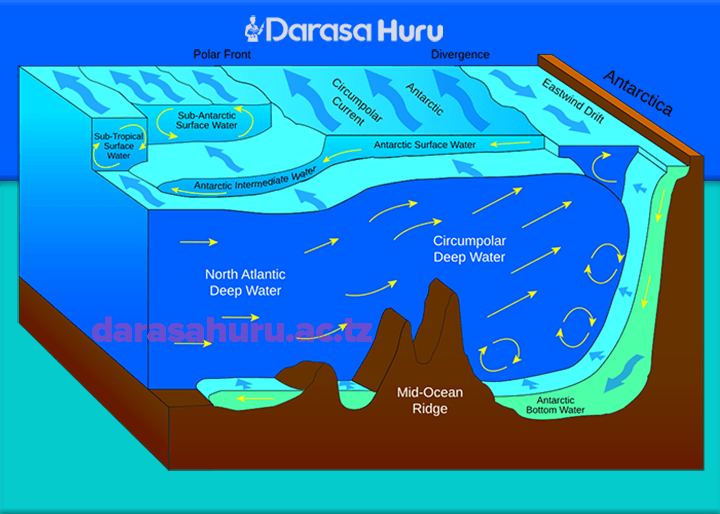
5. Sea floor spreading:
The study made by Professor Herry Hess show the facts that, new oceanic floors are born each year at mid oceanic ridge in the ocean to account for the mechanism responsible for the breaking a part of Pangea and drifting of continents. For instance, the ocean between Africa and S/America (Atlantic Ocean) is widening at the rate of 2cm per each year. The rate exactly account for the present day between the two continents of drift began 200 million years ago. vi. Jig Saw Fit of the continents (Matching of continents):
The shorelines of Africa and South America facing each other have a remarkable and unmistakable match. It may be noted that a map produced using a computer programmer to find the best fit of the Atlantic margin was presented by Bullard in 1964. It proved to be quite perfect. The match was tried at 1,000 fathom line instead of the present shoreline.
6. Geomorphological evidence:
This is study of landforms to support the continental drift theory. For instance, the formation of rift valley, Block Mountain, fold mountain, etc all show the fact that continents have been drifting.
7. The Red Sea evidence;
This is beginning as a rift valley 20 million years ago and now is over 300 km wide. It was formed by divergence between African continent (plate) and Arabian plate.
SPECIFIC EVIDENCE OF CONTINENTAL DRIFT THEORY FROM AFRICA
There are many supporting evidences to continental drift theory from Africa. These are: –
i. Similar rock structure along the coast of W/Africa and Eastern S/America eg. Ghana, Nigeria rocks matches the rocks of Brazil and Argentina. This clarifies the validity of continental drift theory in Africa.
ii. The Jig Saw Fit Puzzle of southern continents which were the pre-existed Gondwanaland eg. Matching of Africa, S/America, India, Antarctica, Madagascar and Australia.
iii. Presence of glacial deposit in Africa such as D.R.C and S/Africa seen to resemble to those of India and S/America hence suggest the paleomagnetic evidence of continental drift theory.
iv. Presence of rift valley eg. the Great East Africa Rift Valley show the initial disintegration of Africa as drifting divergent movement continues.
v. Presence of numerous warping features eg. Lake Victoria, Lake Chad, Congo Basin etc. These occurred due to drifting force during Gondwanaland era.
vi. Presence of Red sea as an evidence of continental drift began when sea water collected in the widened rift valley some 200 million years ago and now is 300km wide.
vii. Presence of volcanic features along the side of rift valley and continues earth tremors show the drifting process still continues.
viii. Similar geological arrangement between North Western Africa and Florida in North America. The two continents had joined during Pangaea time.
ix. Presence of similar fossils remains along the Africa, India and S/America also validates the continental drift theory.
CRITICISM (CRITIQUES) OR OBJECTIONS OF CONTINENTAL DRIFT THEORY
The following are the criticism/weakness/objections of continental drift theory;
1. Wegener was failed to explain convincingly the causes and mechanisms of continental drift theory. Example centrifugal force was rejected by scientific community because the actual force generated by earth rotation were not sufficient to move the continents. (Causes and mechanism critique)
2. The evidence of using Jig Saw Puzzle Fit (matches) of continent was not easily accepted, because not perfect fit of all continents to each other. (Jig Saw Puzzle critique)
3. The physical process that separated the continents was weak and strongly criticized on valid physical grounds. Example how Pangaea separated; how Laurasia and Gondwanaland separated to form the current continents. (Physical process critique)
4. . Wegener failed to explain on the development of glacier in the hot desert such as Iran’s hot desert that exist to the present. (Paleo-climatological critique)
4. Wegener was opposed simply because he was meteorologist without knowledge on Geology. (Expertise critique)
6. The remains of flora and fauna may have been taken to other sides of the continents by the agents of denudations such as winds, and water (waves or ocean currents) (Biological evidence critique)
CONSEQUENSES/EFFECTS OF CONTINENTAL DRIFT THEORY
1. Formation of physical features eg. Mountains, oceans eg. Atlantic Ocean, seas eg. Red Sea due to divergent between Africa and Asia plates, and rift valley.
2. Climate changes. The long-term shift in weather conditions due to changes in temperature, precipitation, winds, etc. as a result of high temperature at equator and low temperature away from equator (at the poles).
3. Ocean currents pattern changes. Eg. the water around the New Zealand; South Island cooled from 200C as the beginning of Paleocene period about 56 – 14 million years ago to 170C during 30 – 14 million years ago, and then cooling to the present 120C.
4. Evolution of animals and speciation. The rearrangement and displacement of land masses helped to create the diversity of animals which are seeing today. Eg. the distribution of the flightless running birds or ratites in S/America, Africa and Australia is the result of breakdown of the Pangaea.
5. Crustal deformation. The drifting of continents causing the natural catastrophes such as earth quakes, volcanic eruption and tsunamis. As a result of crustal deformation through fold, fault, volcanic eruptions, etc.
6. Economic activities changes. Continental drift resulted into features like sea, oceans, rift valley and mountains. These features have brought various human activities such as fishing and tourism. Also due to changes of some economic activities like Agriculture, etc.
CLICK HERE TO GET PDF